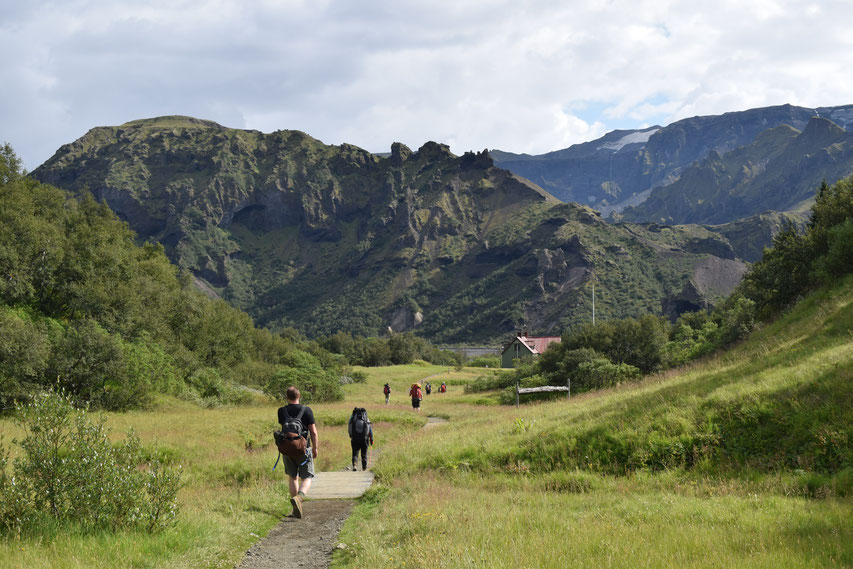
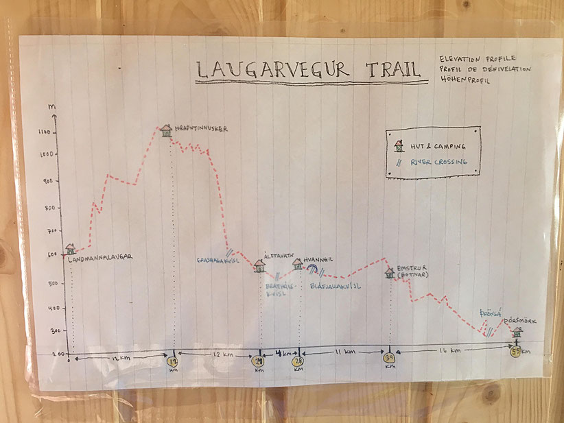
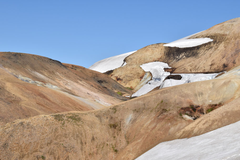
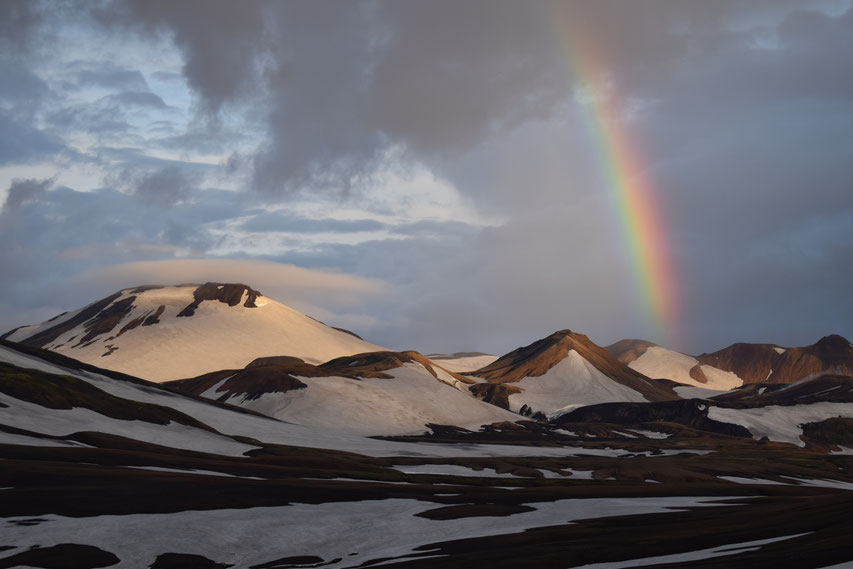
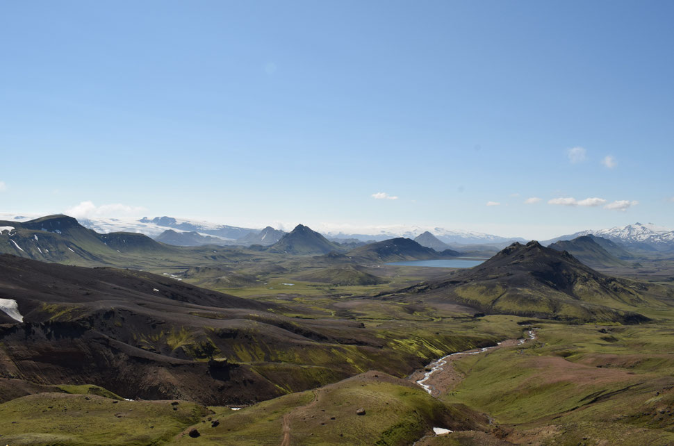
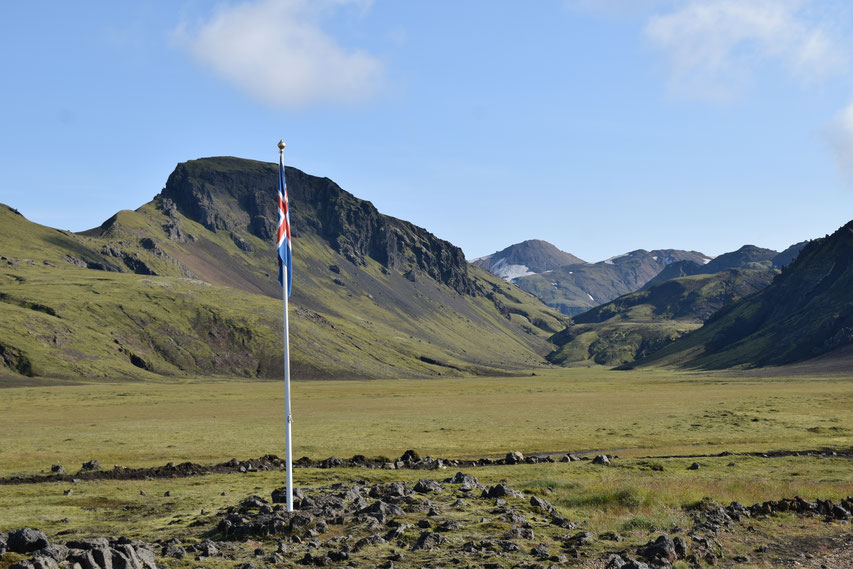
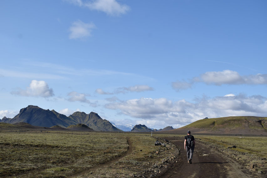
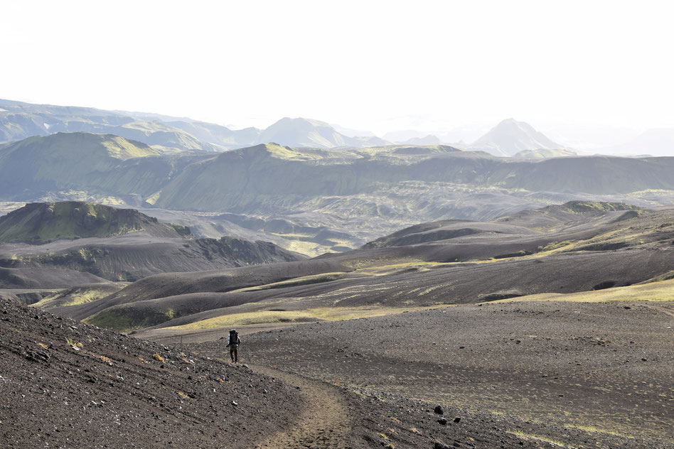
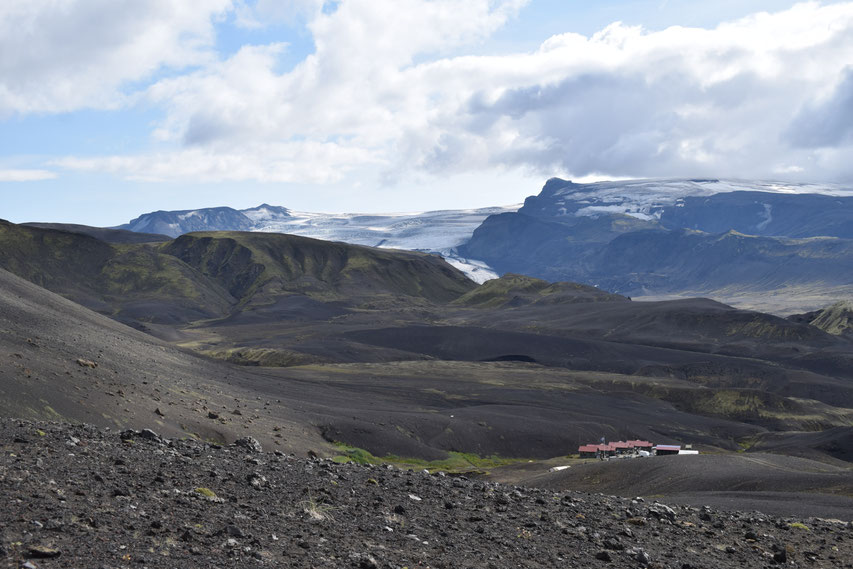
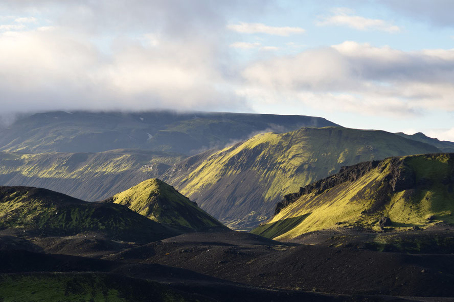
The Laugavegur is Iceland's most popular multi-day hike for good reason. Starting amongst the colourful rhyolite mountains in Landmannalagar, the trail climbs up into the snow fields and desolate black rock piles towards Hrafntinnusker, before descending into lush green moss and the beautiful lake at Álftavatn. Flowing through the valleys, there are several rivers to cross near Hvanngil, before the path leads further south over the black sand deserts of Emstrur—where every tiny green plant looks alien against its inhospitable backdrop. Finally, the trail comes to an end in the lush forests of twisted birch trees around Þórsmörk: a valley at the base of two glaciers.
Firstly, apologies that this post reads as one long lecture about all the things to do, not do, and be scared of. I'm publishing it to help readers prepare, rather than as inspiration, but I certainly do not mean to put you off. I have been working as a warden along the trail since 2017, and these are the things that I always wish hikers knew before they arrived.
This information is not official, but just from my personal experience. It is not a substitute for talking to the wardens in the Information Office at each hut, as there are some things which cannot be checked online. The hike is always dependent on the weather and other conditions on the trail.
Included in this guide:
- Sleeping – choosing to stay in a hut or camping
- Important advice before you arrive
- Hiking responsibly
- Once you start hiking
- Campsites and things to be aware of along the trail (North to South):
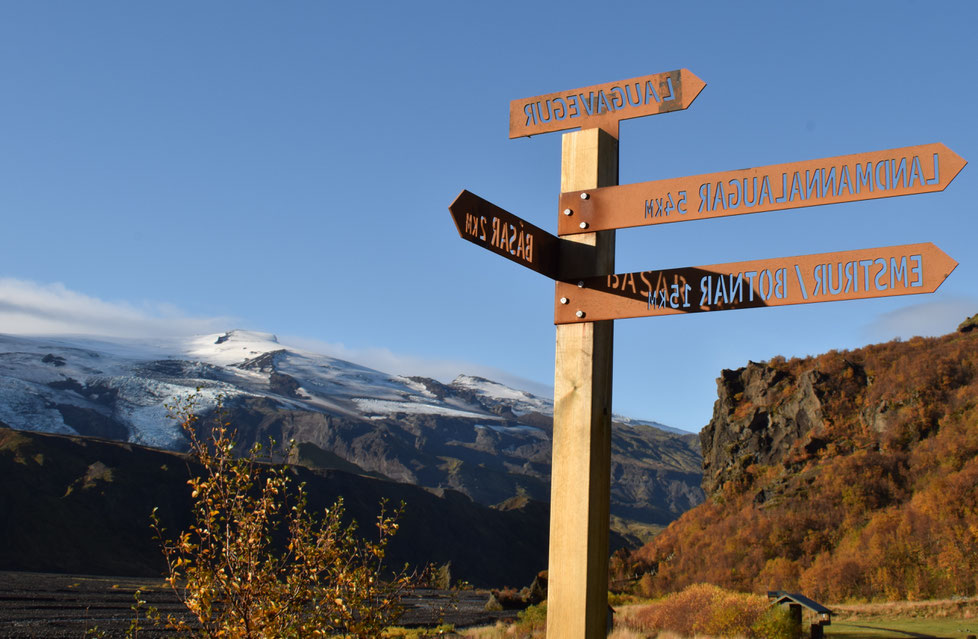
- Landmannalaugar
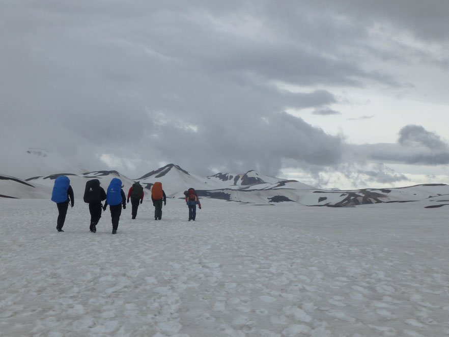
- Hiking Landmannalaugar to Hrafntinnusker (12km)
- Hrafntinnusker
- Hiking Hrafntinnusker to Álftavatn (12km)
- Álftavatn
- Hiking Álftavatn to Hvanngil (3.8km)
- Hvanngil
- Hiking Hvanngil to Botnar/Emstrur (11km)
- Botnar/Emstrur
- Botnar/Emstrur to Langidalur, Þórsmörk (16km)
- Langidalur, Þórsmörk
Sleeping - choosing to stay in a hut or camping:
If you are an unseasoned camper, slightly nervous multi-day hiker or just don't want to carry the weight of a tent, staying in the accommodation huts is the most sensible option [other than a guided tour]. You will have to book well in advance (in 2023, it is 11,000kr per person, per night, but check prices through the previous link). The communal sleeping arrangements are basic, but safe, warm, and dry (which is all you really need at the end of a long hike). There is no privacy and it can feel quite cramped, you must go to a different building to use the toilets, and you will need your own sleeping bag. Each hut has a fully equipped kitchen for sole use of those who are staying in the hut, but you will need to bring your own food to cook. To save confusion, always find a warden to check you in before you go inside.
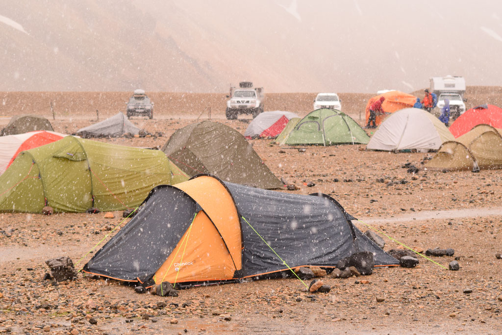
If you decide to stay in a tent, there is no access to the inside of the huts, including the kitchen; some campsites have no shelter at all. You must camp in the official campsites, as the Icelandic Highland environment is fragile and foot traffic is destroying it elsewhere. Camping costs 2,500kr per person, per night (2023) and should be paid in cash or with card upon arrival (bring some cash as solar electricity used to run the card machines can be a little unreliable in some campsites). If you arrive after 10pm (or the office is closed), set up your tent and pay in the morning.
Important advice before you arrive
- If you are not an experienced or fit hiker, do some day hikes with a full backpack as training in advance.
- The season opens in mid to late June and ends around the middle of September. For the best conditions, hike in July, August, or very early September. Remember that Iceland begins to lose light in August, and by September the hours of darkness increase dramatically each night. You can check a rough estimate here, but always plan to be safe at a campsite at least an hour before sunset.
- Check my suggested packing list here before you leave home and do not carry extra luggage for the hike. The best idea is to leave your city jeans, trainers and other everyday items in Reykjavik.
- Check bus routes and times before you arrive; this is particularly important at the beginning and end of the season (June and September) when services are reduced and finally finish altogether. Reykjavik Excursions sell a hiker's passport, which will allow you to be flexible in your plans and allow you to change your ticket if they have space.
- If you are driving and leaving your car at Landmannalaugar, check that the F208 from the north is open first to avoid river crossings. The route is still only possible in a 4x4.
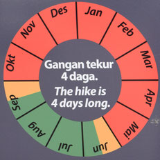
- Walking the trail usually takes between two and four days depending on your fitness, enthusiasm, and most importantly, the weather. Remember that the dates you arrive and leave on a bus cannot be full hiking days. Plan to allow yourself at least one extra day on top of your estimated completion time to allow for unexpected storms. This will let you delay your departure or spend a day stuck somewhere in the middle without extra stress. There is plenty of beautiful hiking in Þórsmörk (pronounced "Thorsmork") or Landmannalaugar if you find you have spare time.
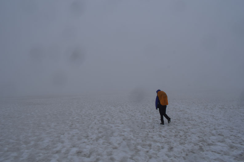
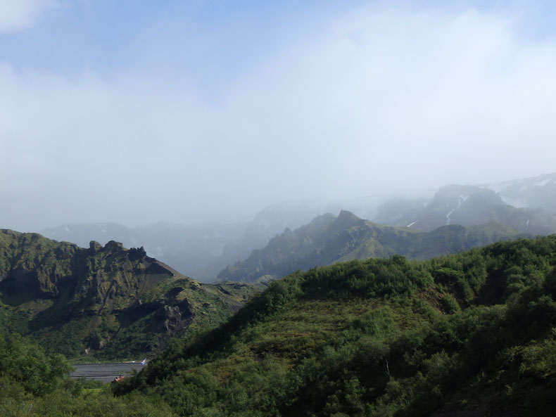
- Check the weather forecast before you leave civilisation! Landmannalaugar campsite is grim in a storm and the route up to Hrafntinnusker is potentially treacherous in bad visibility. Some campsites do not have a covered place for you to sit.
- Register your travel plans with Safe Travel and follow them on facebook or twitter for up-to-date advice before you arrive. Please provide as much information as possible when you fill out the forms, and only choose to have trip monitoring if you will be sure to remember to check out (otherwise you will accidentally call out a Search and Rescue team).
- Be aware that there is probably no electricity for either hut guests or campers en-route (bring a fully charged power-bank and/or spare batteries for anything you need).
- Remember that there is always a chance that you may not be able to do the hike because of bad weather. If you are told not to hike by Safe Travel, a warden at a one of the campsites, anyone working for Slysavarnafélagið Landsbjörg (Search and Rescue), or a ranger from Umhverfisstofnun (The Environment Agency), it's imperative that you listen to their advice.
All within 24 hours at Landmannalaugar in late June.
Hiking responsibly
- For the preservation of moss and other plants, please only walk on the trails and do not wild camp.
- Prepare to take your rubbish home with you. Bring a small trash bag or ask the wardens if you forget. If you see something left on the trail, we would really appreciate if you could pick that up too. You can use the bins in Landmannalaugar, Hvanngil, and Þórsmörk.
- There are toilets every 12km, so please do not poo(p!) in the wild and take any toilet paper along with you.
Once you start hiking
- Always talk to the wardens before you start the hike and when you reach a new campsite (regardless of if you stay at that particular one or not). They might have vital information regarding river conditions, incoming storms, or even [hopefully not] an impending volcano eruption... Be aware that Icelandic people are not prone to over-exaggeration—if they advise you against something, it is almost certainly for a good reason.
- Although there are 24 hours of light around Midsummer, you should not attempt to hike through the night [without serious training and experience]. The temperature drops dramatically in the evening, there is nobody to help you on the trail if you need it, and your body will get tired even if you feel awake. From personal experience, I know this can catch up with you despite being physically fit.
- Make sure everything in your bag is protected from water in dry bags, bin bags, or both.
- For river crossings -
-
- Choose the widest [and therefore most shallow] part of the river.
- Change into your river crossing shoes.
- Tie the laces of your boots together and hang them from the back of your neck/bag (keep your hands free for balance).
- Unbuckle the waist belt of your bag.
- For deep rivers, link elbows with your companions, and wade across sideways. Put the strongest, biggest, or most confident member of your group first to help lead the way.
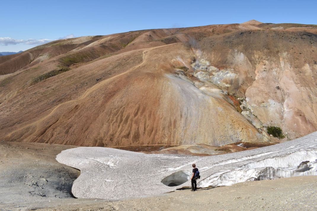
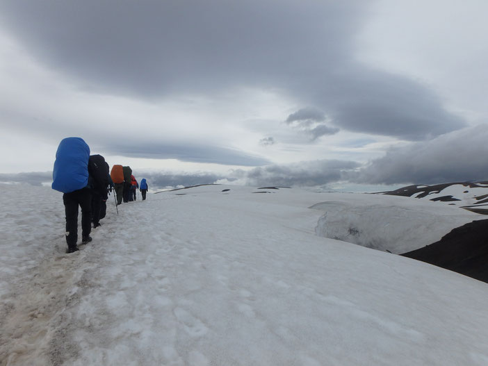
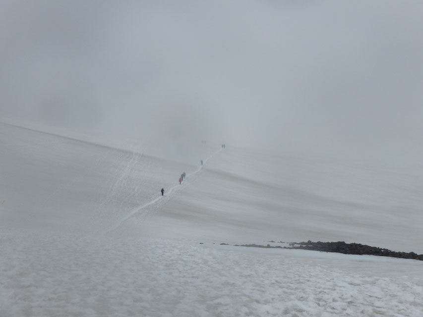
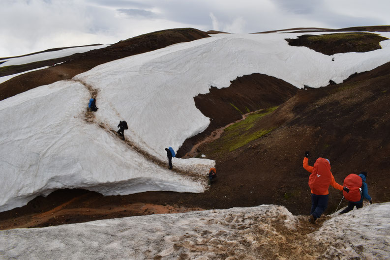
- When crossing snow bridges use caution and common sense; if you need to cross one, step carefully to test them a little before putting your whole weight down. Look for cracks and holes before you step. Do not follow foot-prints if they are leading over something that does not look safe (more snow melts every day).
- If you are cold and wet, it is important not to panic, but just put on extra layers and keep moving. Consider your position on the trail: if you are hiking south and are already totally cold, wet, and miserable before you reach Hrafntinnusker (particularly if you are camping), it might be worth considering going back the way you came... There is no bus service from the middle of the trail.
- Eat plenty of food and drink enough water; you will use more calories than you expect. Keep easily accessible snacks in your pockets, so you don't always have to sit down and stop in bad weather. All tap water is drinkable in the campsites, and you can also drink anything from small mountain streams that don't smell of egg (take from upstream of the trail). I would usually say you should take 1.5 litres for the first section to Hrafntinnusker, but you probably don't need to carry more than a litre after that.
- Call 112 in an emergency. It is important to keep track of where you are with a GPS (especially important early in the season when there is a lot of snow), so the rescue team can find you quickly if you call. Do not be afraid to call them (in English is fine) if you are injured or lost in bad weather, but be aware that they are quite likely to hike out to get you, so it might take some time before you can be rescued.
Huts, campsites, and things to be aware of along the trail (North to South):
It is totally possible to walk the trail in the other direction, but it might not be as fun for obvious reasons...
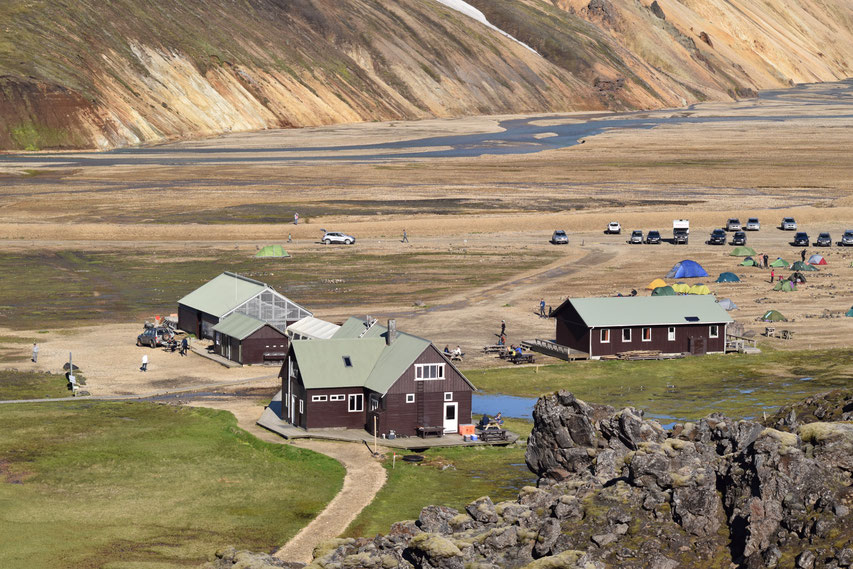
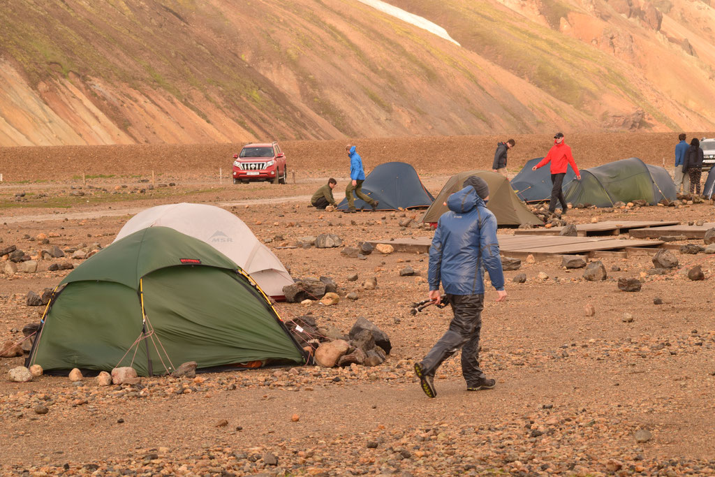
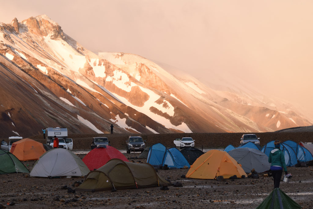
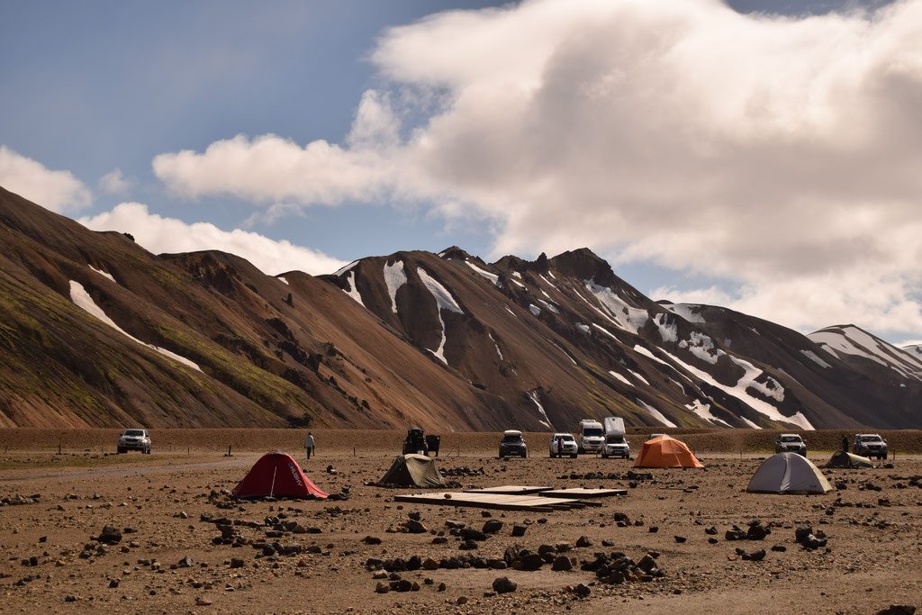
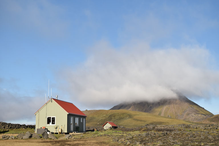
Landmannalaugar
GPS coordinates: N 63°59.600 - W 19°03.660. Elevation: 550m
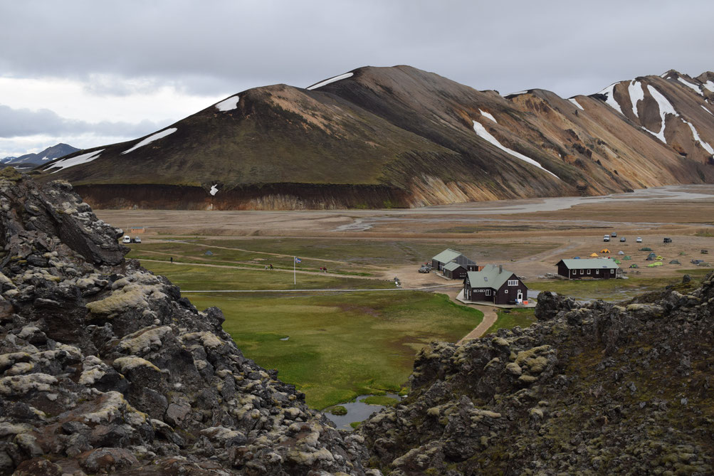
Though it has slightly better facilities than most stops on the trail, the camping area has a base of rocks and—in keeping with the general Highland ethos—things are pretty basic. I've also written about day hikes from Landmannalaugar.
You will find:
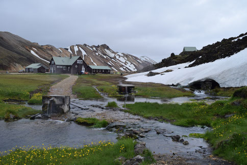
- Parking: accessible without any river crossings with 4x4 vehicle when F208 road is open.
- A beautiful natural hot spring (getting warmer throughout the season).
- Toilets, a sheltered tent area for eating, and rubbish disposal/recycling—all included in camping (2,500kr) or the day fee (500kr).
- Warm showers: 500kr for 5 minutes hot water.
- Information Office also selling maps, certain types of gas, power banks, snacks, and various other things. Call ahead to check stock/prices. Telephone number (not for bookings) - 00354 860 3335.
- The Mountain Mall are also open from late June until early September. They sell coffee and many other things from their shop in the old green buses.
- A rotation of Search and Rescue teams are based in Landmannalaugar between July and August. For medical issues, injuries, or fears about lost hikers, you can visit them in their bright red hut.
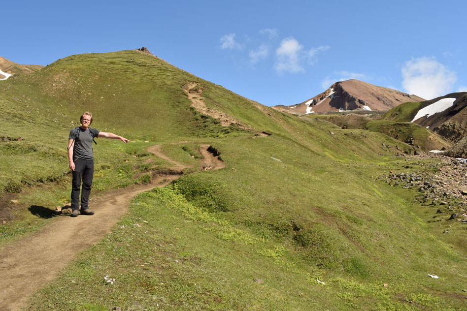
Hiking Landmannalaugar to Hrafntinnusker (12km)
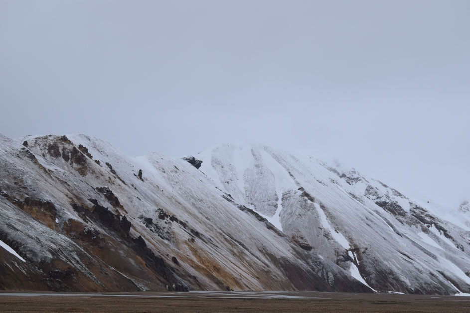
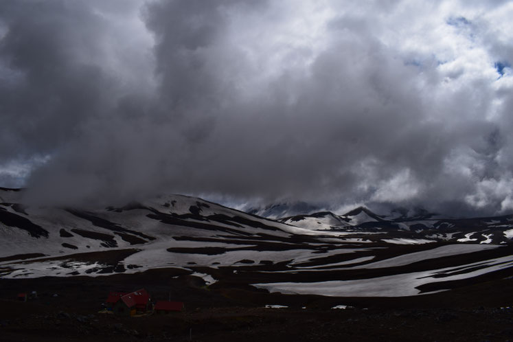
This first section of the hike is usually the most challenging. Time your departure around having decent weather on this day as it can be dangerous in poor conditions. The majority of the stretch is up-hill, the weather can be at its most serious at the higher altitudes, and (in the first half of the season) there is a lot of tiring, wet snow to walk across. Be especially careful in low visibility and when walking over snow bridges.
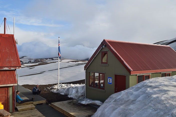
Hrafntinnusker
GPS coordinates: N 63°56.014 - W 19°10.109. Elevation: 1100m
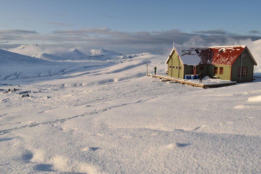
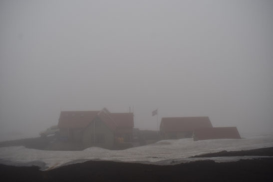
At the highest altitude on the trail and covered in snow for much of the season, this is unlikely to be somewhere you want to camp unless you have real experience and specialised equipment.
There is a now a new basic shelter for campers, but no showers and only "long drop" type toilets (which smell horrendous).
On the plus side, it is all downhill from here in both directions!
Camping: 2,500kr
Hiking Hrafntinnusker to Álftavatn (12km)
There is usually still a lot of snow on this section early in the season, but it should not be so exhausting as it is mostly downhill. Take your time on the steeper sections, as (when you are tired) this is the most likely place to twist your ankle or hurt your knees.
There is a river-crossing closer to Álftavatn, but it is rarely more than calf-deep.
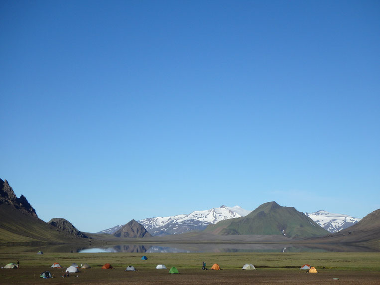
Álftavatn
GPS coordinates: N 63°51.470 - W 19°13.640. Elevation: 550m
Sometimes known as the Windy City, this campsite has a beautiful lakeside location and is idyllic in good weather. There is no shelter, so if the wind is getting strong (check with the wardens), then be prepared to continue the 3.8km to Hvanngil as tents are often destroyed at Álftavatn.
- Camping costs 2,500kr.
- There are [only two] warm showers on a 500kr for 5 minute ticket system.
- Phone number (to check conditions, not for bookings): 00354 823 4008
- There is also now a (very small) restaurant run by the Volcano Huts company, which is usually open in July and August.
Hiking Álftavatn to Hvanngil (3.8km)
It is only 3.8km between Álftavatn and Hvanngil, but be sure to check conditions of the river crossing with the wardens before you start. Usually it is not more than knee-deep, but can be fast or flooded at times.
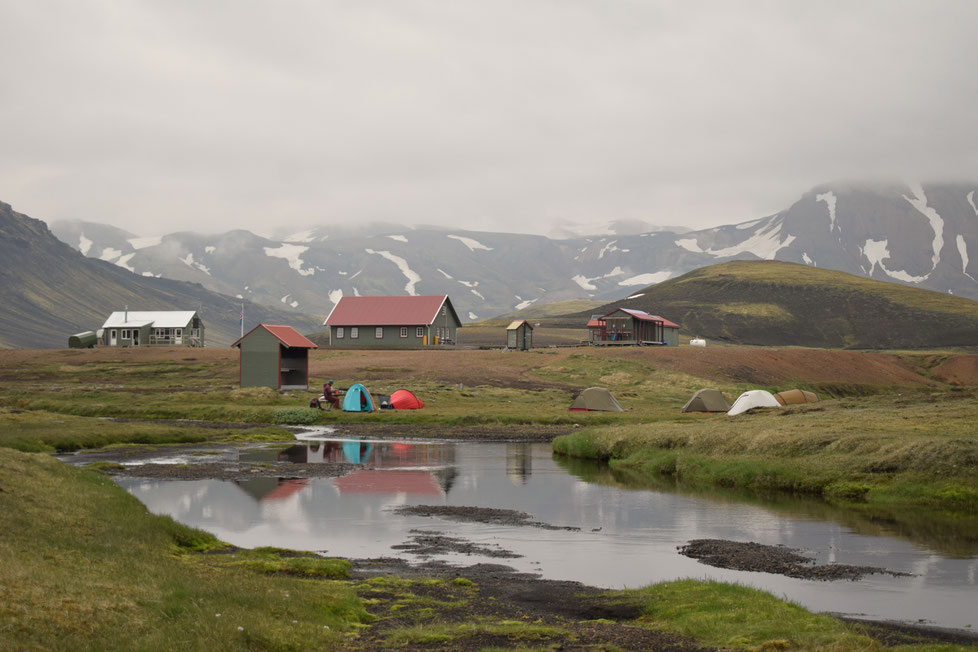
Hvanngil
GPS coordinates: N 63°50.026 – W 19°12.507. Elevation: 550m
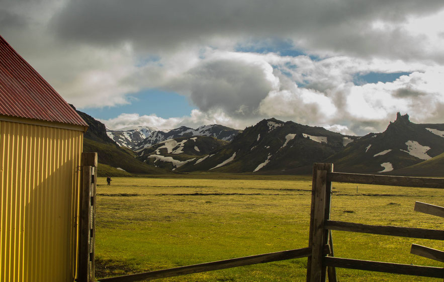
The least busy and most sheltered campsite, Hvanngil is often overlooked. Most people walk right through, but it is usually an excellent place to camp. Even if you can't stay, please be sure to talk to the wardens and check the conditions of the next river 1km afterwards, as this is normally the deepest on the trail.
- Camping costs 2,500kr
- Showers 500kr for 5 minutes
- Telephone number (to check conditions, not for bookings) - 00354 860 3336
Hiking Hvanngil to Botnar/Emstrur (11km)
The river just past Hvanngil can be as deep as your bum, so make sure the things in the bottom of your bag are well protected. I personally like to do it without wearing my trousers most of the time...
Walking across the alien, black sands of Emstrur can actually be more challenging in dry and windy conditions, as sand whips up into your face. Sunglasses, a hat, and a buff will help with this problem.
Botnar/Emstrur
GPS coordinates: N 63°45.980 -W 19°22.450. Elevation: 465m
If the weather is acceptable, don't pass through here without seeing the canyon. It's an easy walk away (even for the most exhausted hiker) and one of the most impressive views in the area.
- Camping: 2,500kr per person
- Showers 500kr for 5 minute (currently taking 100kr coins rather than tickets).
- Telephone number (for questions, not bookings): 00354 490 0137.
Botnar/Emstrur to Langidalur, Þórsmörk (16km)
There is a final river crossing before Langidalur which is not usually much more than knee-deep, but can sometimes become very fast flowing. It's otherwise not a very strenuous day, apart from its length, which can be tiring at the end of the trek.
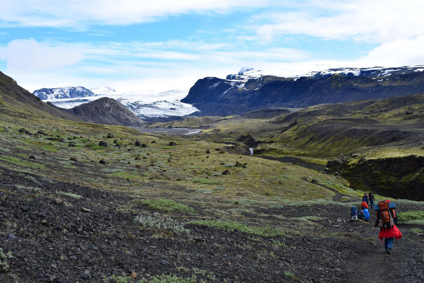
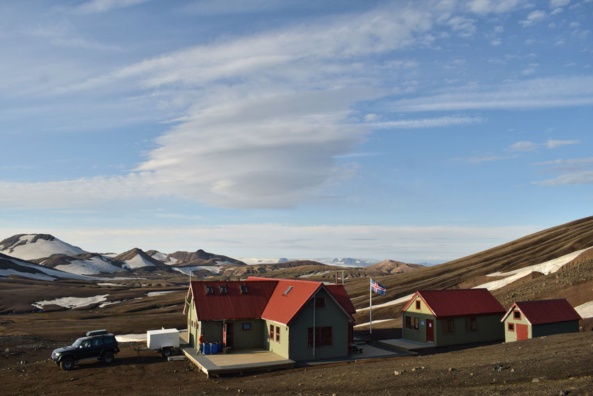
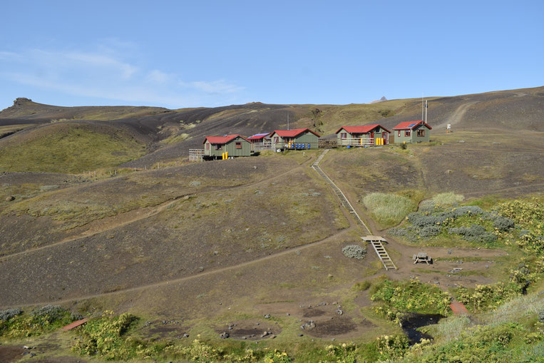
Langidalur, Þórsmörk
GPS coordinates: N 63°40 960 - W 19°30.890. Elevation: 200m
There are several huts/campsites in Þórsmörk: Langidalur is run by FÍ, Básar is run by Útivist, and Húsadalur is run by Volcano Huts. As I have only worked at Langidalur, I'm going to talk about that here, but if you are continuing on to hike the Fimmvörðuháls trail, it's a good idea to camp at Básar, which will give you a little bit of a head start in the morning.
After finishing Laugavegur, you deserve a break, and camping at Langidalur is usually a much more inviting prospect than the more severe conditions further north on the trail: there is grass to camp on and an incredible view over Eyjafjallajökull and Mýrdalsjökull glaciers. Langidalur have a map of day-hikes to buy, and everything is pretty well sign-posted thanks to the TrailTeam volunteer program (which was how I came to live and work Summers here in the mountains). Be sure to protect your food from mice (outside your tent in hard plastic or metal) as they are likely to nibble through expensive gear to get at it. Langidalur is relatively well-equipped compared to campsites in the middle of the trail: there is a small shop, which sells beer, shelter to sit undercover, and warm showers on a 500kr for 5 minute ticket system. Camping costs 2,500kr per person.
If you are starting either the Laugavegur or Fimmvörðuháls (to Skogar) from here, it is important you check conditions with the wardens first.
Never attempt to wade or drive a hire car through Krossá river, as it is nearly always extremely dangerous. In the high season, there is a foot bridge a little further
upstream, which sometimes has to be removed because of flooding—if that is the case, you will need to speak with the wardens about your
options.
Langidalur telephone number (to check conditions, not for bookings): 00354 893 1191