I'm not going to pretend this is the "ultimate guide" or draw you a map as, having worked there for much of the last two summers, I know how important it is that you talk to the wardens at Landmannalagaur and ask for their most current advice. Please refer to the text at the bottom of this page for information you should know before you arrive.

Suitable for most people, the Laugahraun loop is the shortest and easiest route. Suðurnámur, Brennisteinsalda and Bláhnúkur are three different mountains which can be hiked either individually, usually taking between two to four hours, or (if they are all open) combined together as a larger loop which could take an entire day.
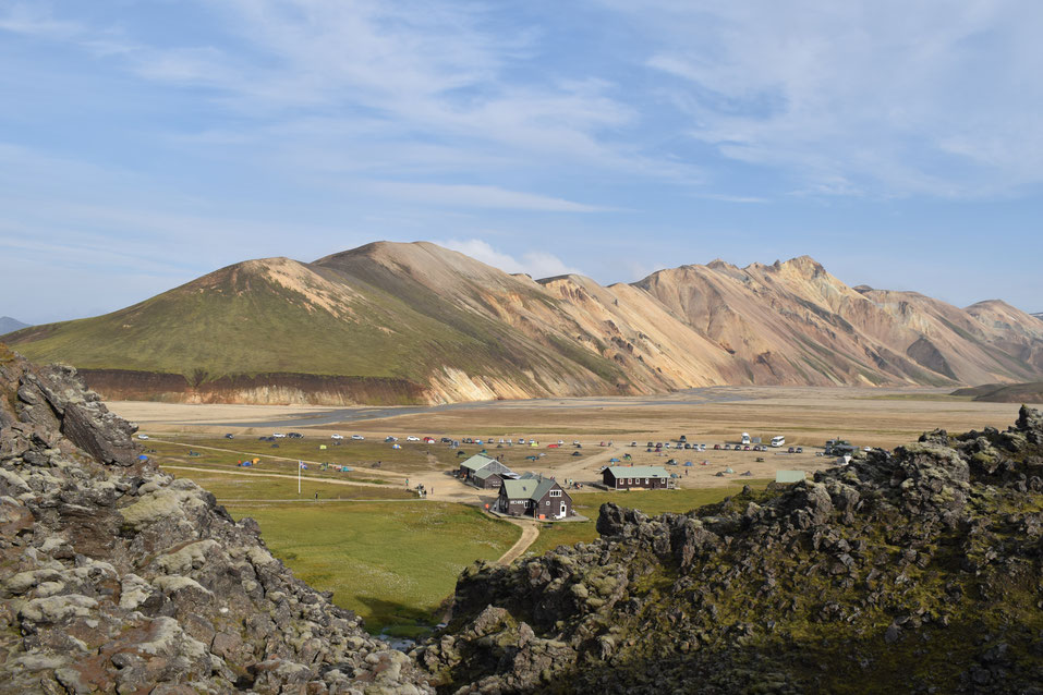
Laugahraun Loop/Laugahringur 4.3km
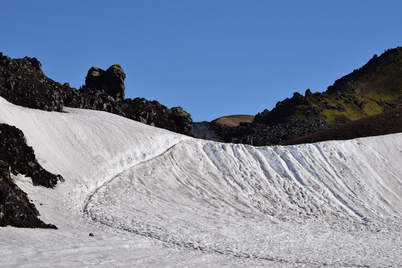
This shortest circle is usually the best option for those without a lot of time, families with young children or people who are not used to hiking longer distances. Though it has some challenges – especially earlier in the season when there is still snow to walk across – there is no great climb in elevation and it is well marked.
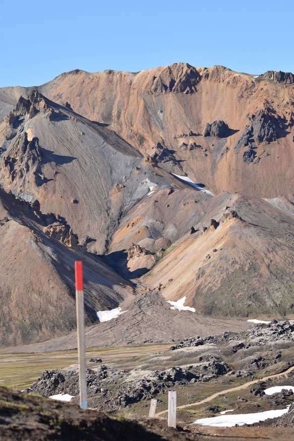

Suðurnámur
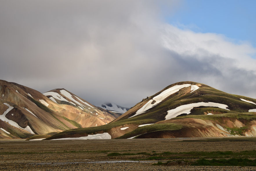
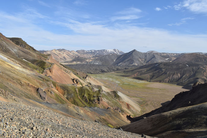
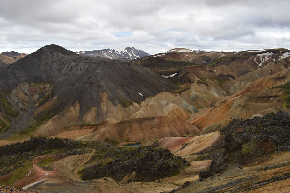
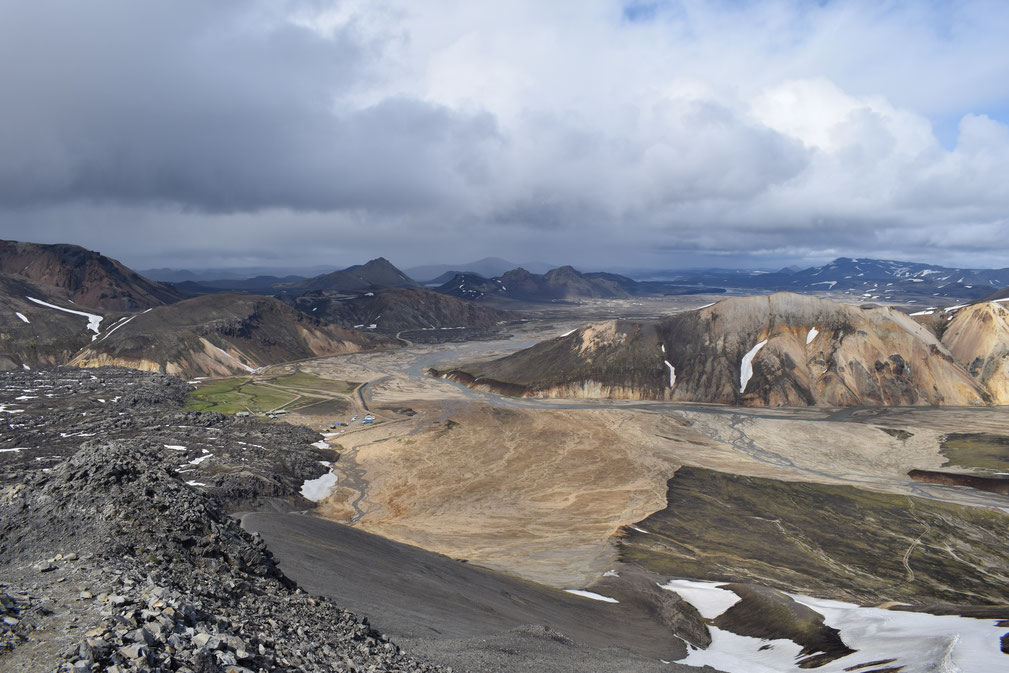
If you have plenty of time, starting with Suðurnámur will give you the most flexibility. Begin on the eastern slope of the mountain, by the road, and follow the marked path up to the top of the ridge. This can feel pretty steep, but you will soon be rewarded with a bird's-eye-view over Landmannalaugar and the lava fields. Craggy Námsfjöll runs parallel in the north and on a clear day you can see the lakes and mountains beyond.
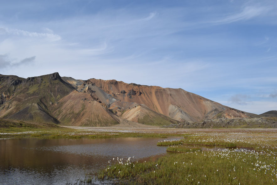
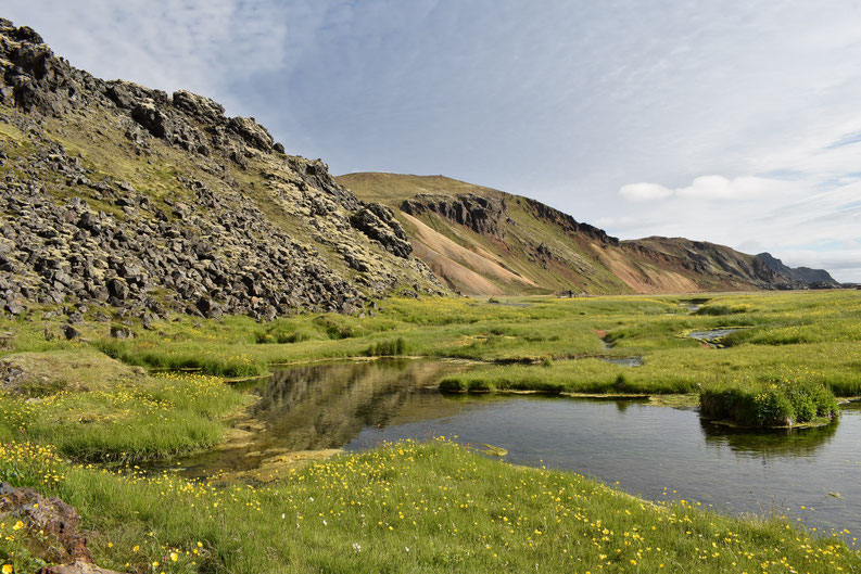
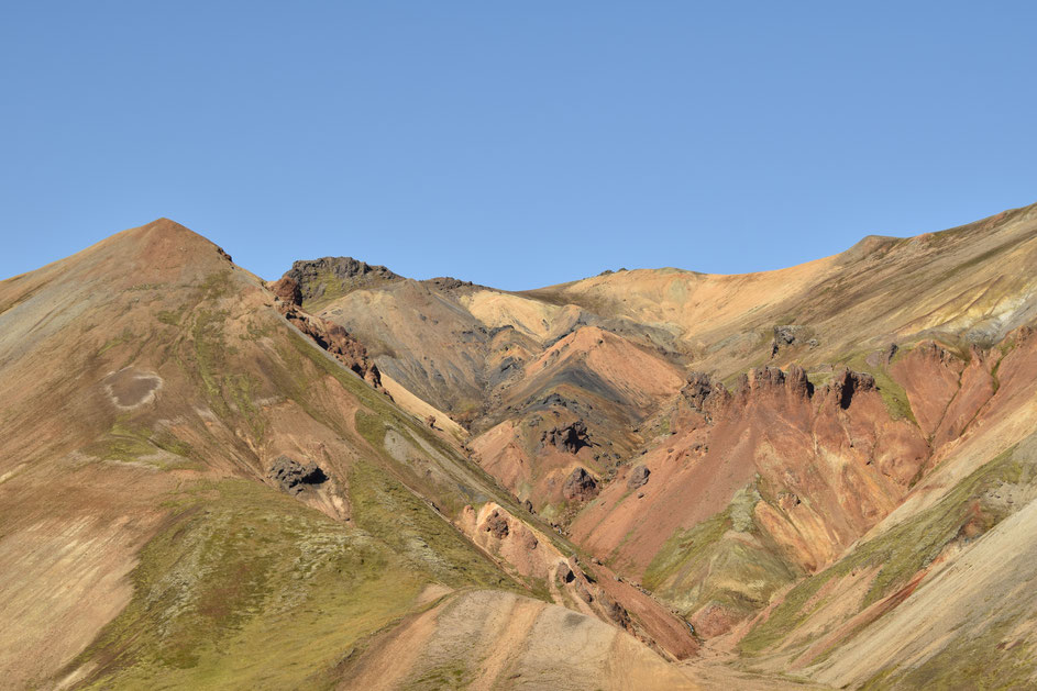
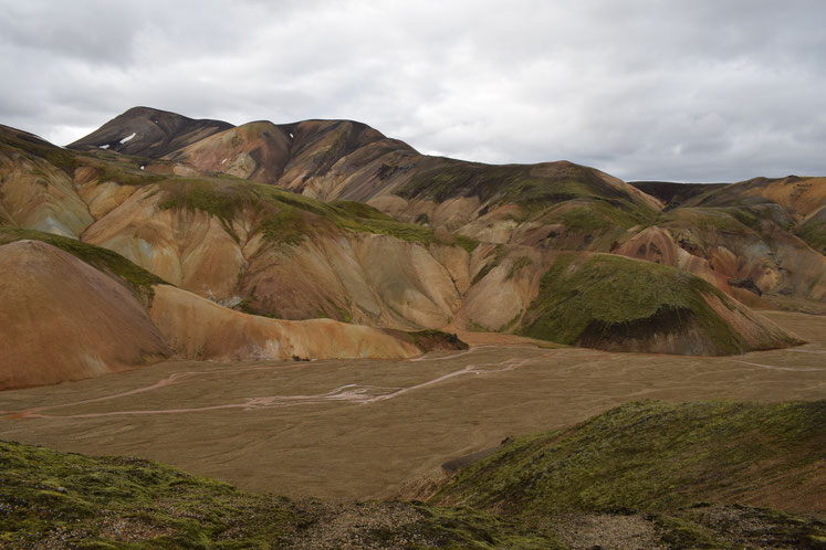
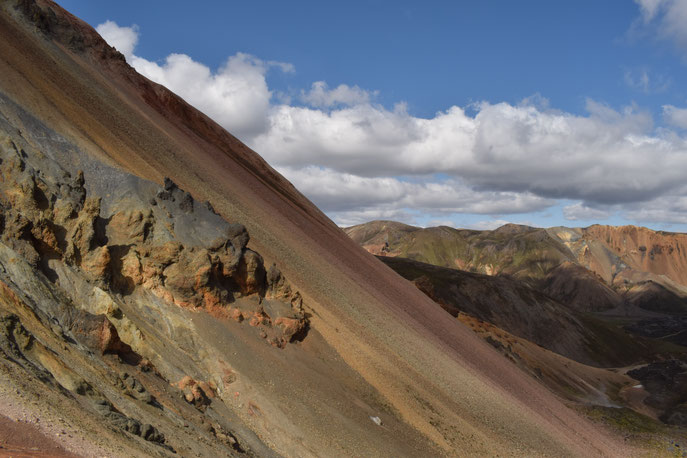
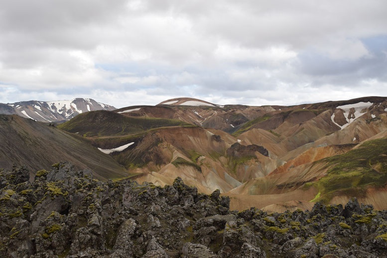
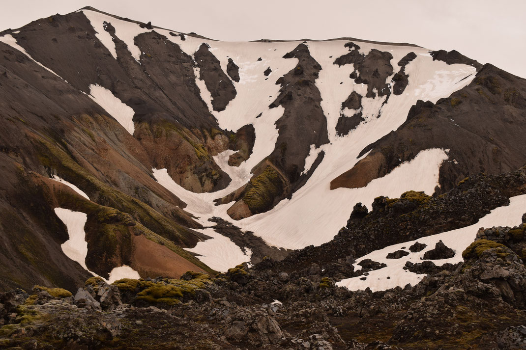
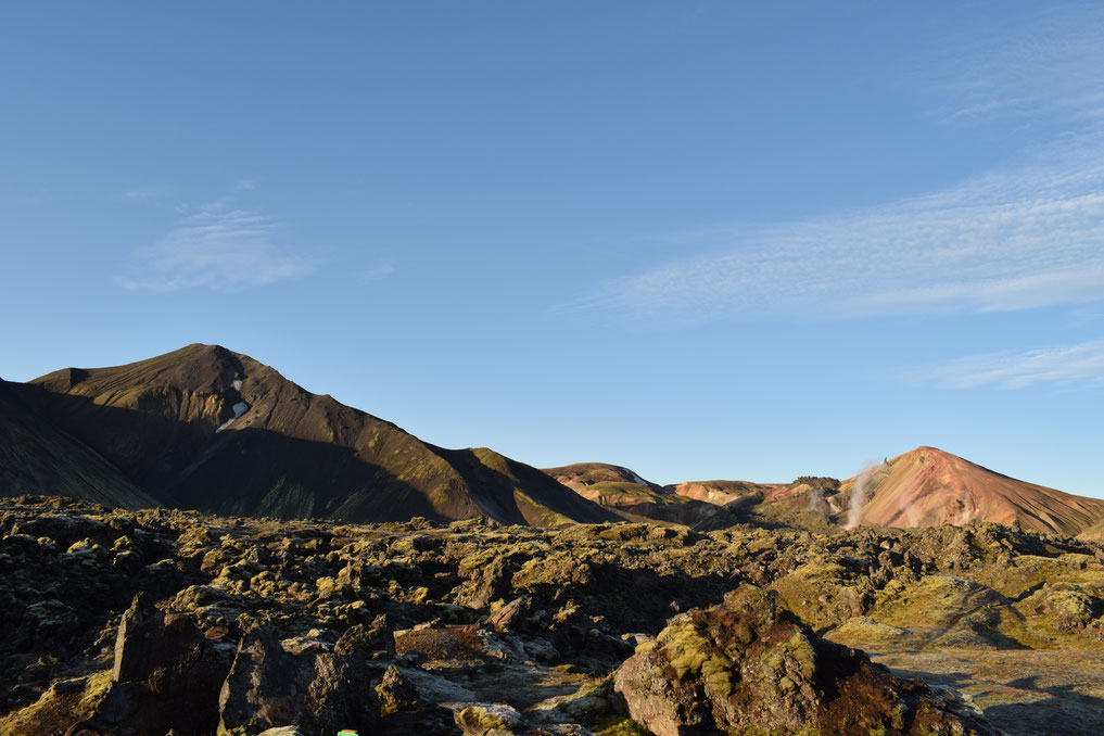
Suðurnámur's path follows its long ridge, which helps you find your bearings in the area. Beyond the valley Vondugil, you can see both Brennisteinsalda and Bláhnúkur further east. Colourful Brennisteinsalda rises directly from the valley and Bláhnúkur is easily recognised by its grey top, which seems to run down it like icing poured onto the peaks.
Having traced the length of Suðurnámur, the path begins to wind back down. Though it is not dangerous, decent walking boots make a huge difference to the difficulty of this section; it is steep in places with loose stones under-foot. The curve in the path allows you to look back at Suðurnámur itself and see the rainbow rock towering over the wild flower meadow in Vondugil.
You will come to a junction, to the right are paths to Háalda and Landmanahellir, but you should take the left down to Vondugil. Follow the white markers across the valley and decide whether you have time and energy to climb one or maybe two more mountains. To climb Brennisteinsalda at this point, you should allow the same amount of time that it has taken you to get this far. Otherwise, simply follow the white markers back to the black lava field on the opposite side of the valley.
Brennisteinsalda
Brennisteinsalda can also be climbed directly by following the red and white marked path through the lava field and white path through beautiful Vondugil.
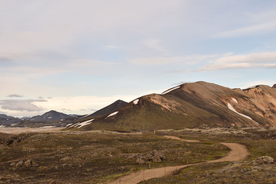
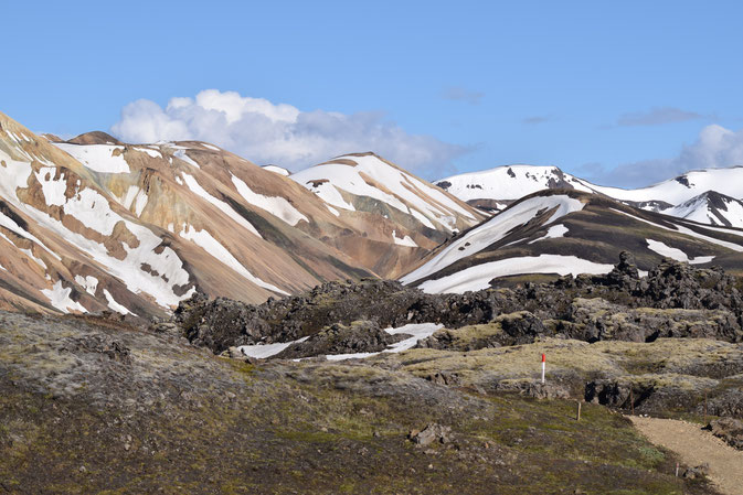
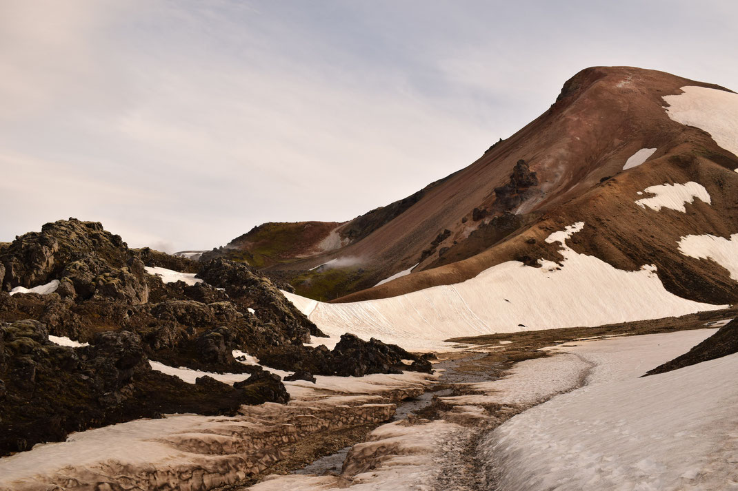
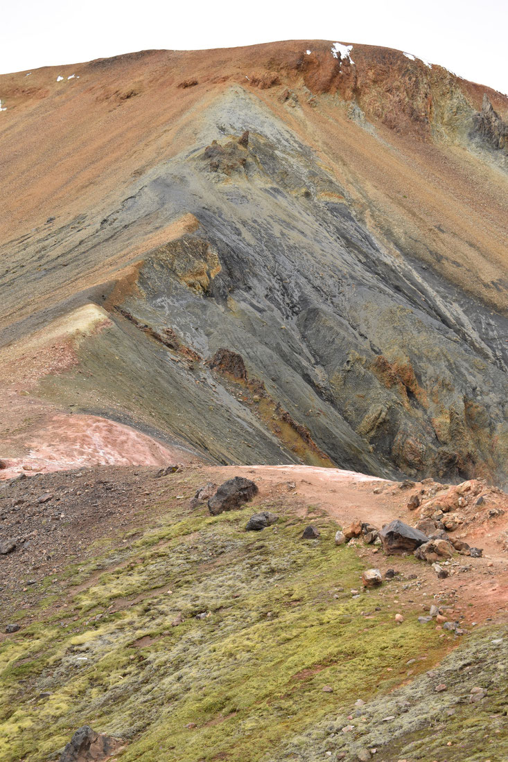
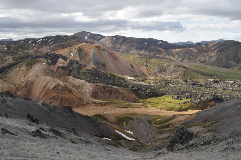
The steep path up from Vondugil is marked at Brennisteinsalda's base with a sign and green markers. Though the first fifty meters looks a little intimidating, Brennisteinsalda is actually the easiest of these three mountains to climb and the one I would recommend for people with less time. You will see the most varied landscapes within this loop and have a wonderful view over the surrounding valleys. It is the heart of the "colourful mountains" which have made Landmannalaugar so famous.
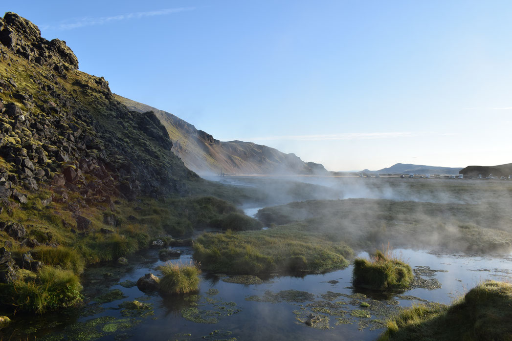
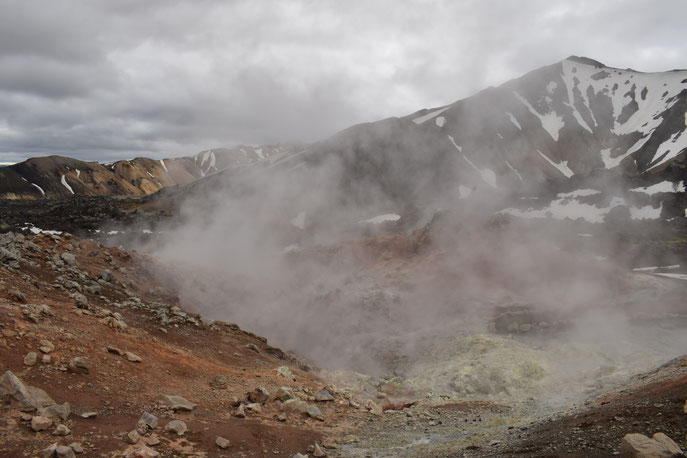
After climbing back down on the eastern side of the mountain and taking a left onto the red-marked Laugavegur trail, you will come across some geothermal activity. The bubbling vents and steam pits, colour stained rock around them, are very exciting for those who come from counties without this kind of thing (like me). Do not go too close.

At the junction, you can head towards Greanagil - "the green valley" and again, decide if you have enough time and energy for another mountain. Allowing two hours more, you can take the marked turning to the right towards Bláhnúkur. Otherwise, continue along the white markers which weave through the lava and along the river towards Greanagil, which is also worth visiting for its startling turquoise rock.
Bláhnúkur
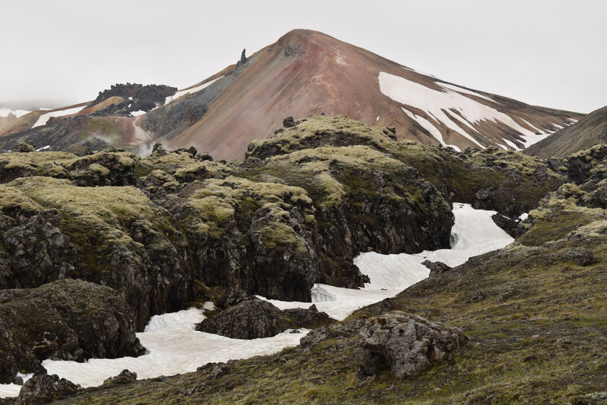
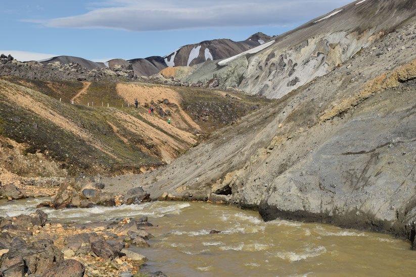
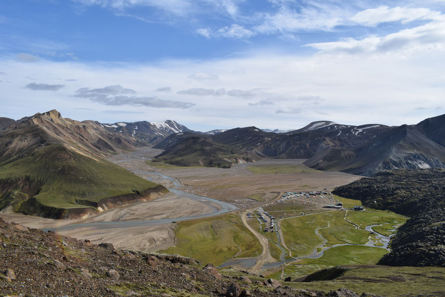
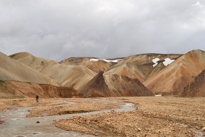
The most challenging climb with arguably the best view, Bláhnúkur is only enjoyable in good weather (when you can actually see the view). It is steep, higher than the others and has small, loose stones underfoot. At the bottom you will have to cross a river, but it is usually not much more than ankle deep. If you are starting this climb from Landmannalaugar, be careful to stay on the main path that comes right around to the back of the mountain, as the first smaller turning to the right is very steep.

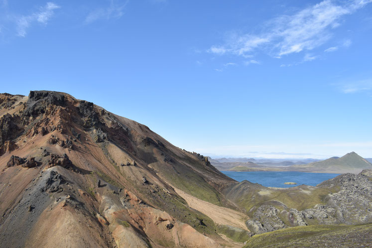
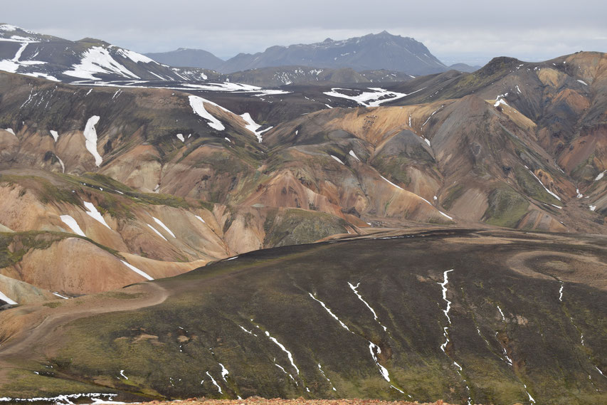
From the higher slopes and both of the peaks, you will have an amazing view of the landscape all around Landmannalaugar; the nearby creme-caramel coloured mountains, Barmur and even several glaciers in the distance on a very clear day.
I have also written about the 15km Skalli hike.
Useful Information (look after yourself and the environment)...
- Speak to the wardens at the Information Point when you arrive:
You should buy a day pass to use the facilities and check the most current advice. There is always a possibility that some of the paths (though probably not the Laugahraun Loop) may be closed; this is usually for the protection of plants or your own safety.
- Nature:
Please carefully stick to the paths in order to save the area's fragile ecosystem. Do not leave litter or toilet paper anywhere. If you would like to contribute something positive during your excursion, bring or ask the wardens for a small plastic bag (and glove if you like) so you can pick up any other rubbish you see on the way.
- Map:
You should always buy a day hike map at the Information Office. Unlike many you will find online, the paths are marked in the correct colours according to the markers on the route. The wardens can also use this opportunity to give you up-to-date advice.
- Weather and seasonal conditions:
The amount of snow on the ground, fog, wind and rain are all important factors to consider. Check the forecast before you leave as Ladmannalaugar is miserable in the rain. Everything is unpredictable, but you can expect June to be more difficult with snow and most of it melting through July and August. September is colder and remember that hours of daylight reduce rapidly into the autumn.
- Costs - prices from the Information Office (correct summer 2018):
-
- If you are only staying one day, the facilities fee is 500kr (includes trash collection, parking, outside seating and sheltered picnic tent, six full-time wardens' wages, the toilets, but not showers). You can bath in the natural hot spring for free.
- A day hike map is 300kr.
- Camping is 2000kr per person and does not need to be booked in advance. It applies to tents and cars (on both sides of the river).
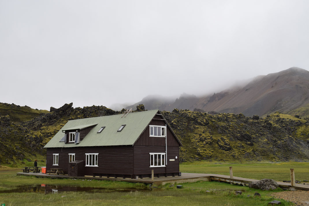
- Staying in a dorm style room in the hut is 9000kr, but you should book ahead through the FI office as it is often full.
- Showers cost 500kr for five minutes of hot water regardless of whether you are staying or not. You can buy a QR code ticket.
- What to bring:
Facilities are basic, there is no inside seating area apart from the picnic tent and mountain mall (converted green busses which are now a small shop/cafe). Even day visitors should arrive well prepared with hiking boots, waterproof jacket and trousers, gloves, hat and layered clothing (preferably not jeans). Charge your phone and camera batteries before you arrive and do not forget a water bottle (you can drink the water from the taps).
- Getting in and out:
You can catch busses with Thule Travel, Sterna, Reykjavik Excursions or Trex. The F208 from the north is the only road in without river crossings, but it is only allowed in a 4x4. Check here for officially open and closed roads, but bear in mind that just because it is open it does not mean it is safe for you or your car.